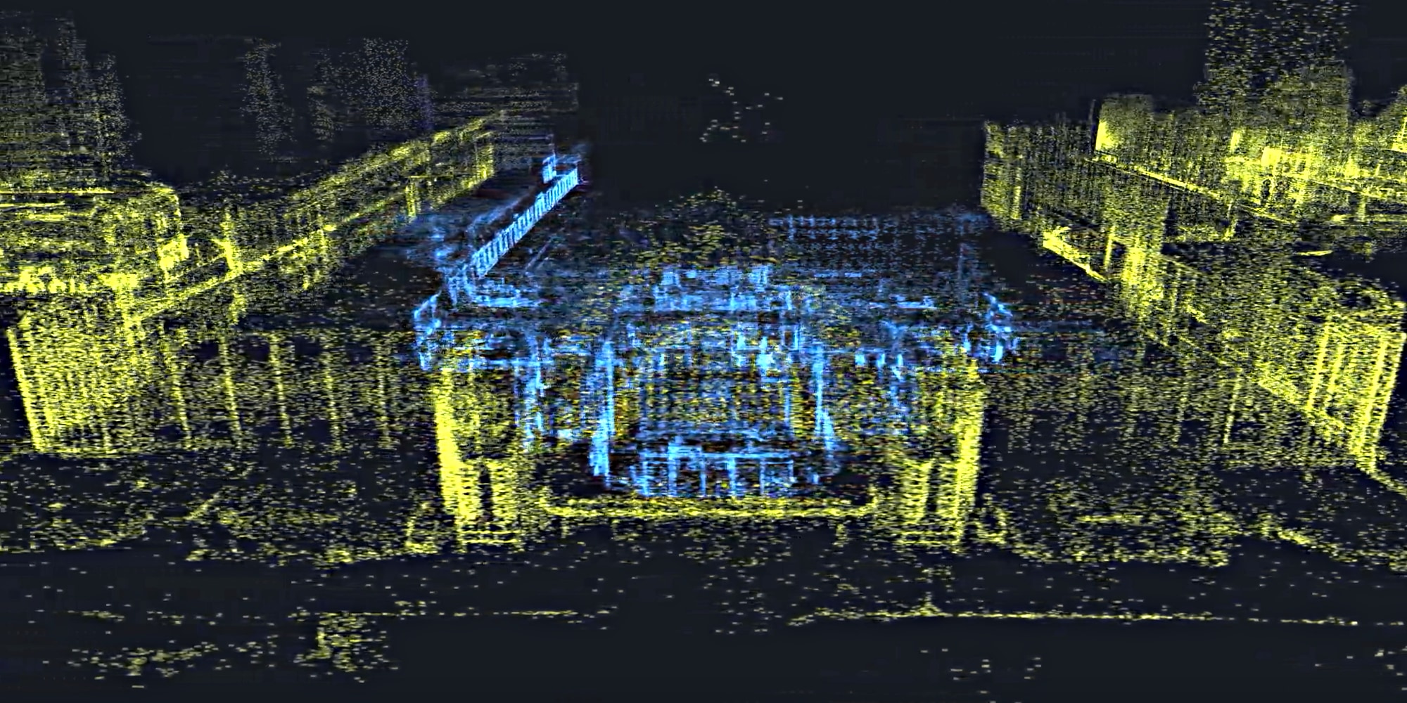
Last year, U.K.-based Scape showed off a city-scale AR mapping solution that promised to let mobile devices tap into 3D maps and persistent, cloud-stored digital assets ranging from AR guidance to advertisements — ambitious technology that led Facebook to acquire Scape last month. Now Finland’s Immersal is spotlighting its competing city-scale AR mapping solution, which uses a mobile app and crowdsourcing to create 3D point maps independent developers can use to create shared AR experiences.
Immersal’s free Android and iOS app captures images of real-world locations as phone users walk through them, tags each image with GPS and orientation data, creates AR recognition point maps from multiple images, then stitches the small maps together into a larger canvas. Holding up the same device, users can then move through the mapped areas with a far higher degree of location precision than conventional GPS — centimeter-level, Immersal says — while seeing AR objects and navigation data that persist for multiple users using globally shared coordinates.

Unlock premium content and VIP community perks with GB M A X!
Join now to enjoy our free and premium membership perks.